

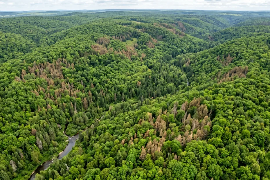
Satellite Imagery For Forest Health Monitoring
Satellite imagery has totally changed how we keep tabs on the health of forests across the planet. These advanced images help researchers, conservationists, and even everyday nature lovers spot subtle shifts and big changes in forest health, all from space. By checking canopy color, noticing gaps, and even tracking leaf moisture, I can get a surprisingly detailed look at forest ecosystems without ever setting foot on the ground. Here’s a peek at how satellite imagery makes forest health monitoring so much easier and why it’s something worth exploring, especially if you’re interested in the environment or want to support efforts that keep forests thriving.
How Satellite Imagery Makes Forest Monitoring Easier
Keeping forests healthy isn’t simple. Forests face stress from droughts, insects, fires, and human activities. Before satellite technology, people had to rely on labor intensive fieldwork, which only covered small patches at a time. With recent advances in satellite imaging, it’s much easier to spot trouble; all you need is access to the right data.
Satellites can scan huge areas in just a few minutes, giving us a full view of forests in near real time. I’ve used platforms like Landsat (operated by NASA and the USGS) and Sentinel (run by the European Space Agency) for tracking changes over time. What’s cool is that these satellites offer data at multiple resolutions, letting you zoom in for detailed checks or keep things broad for spotting trends.
Forest health monitoring is now far more accessible, scalable, and data rich. With many online resources offering free or low cost access to satellite images, everyone can get in on the action and keep an eye on their own patch of green. Plus, these systems allow environmental organizations, students, and citizen scientists to support conservation from anywhere.
Key Ways Satellite Imagery Tracks Forest Health
It’s pretty wild how much you can learn about a forest just by looking at its image from space. When monitoring forest health, satellite images make it easy to:
- Measure Canopy Greenness: Healthy trees tend to look greenest in satellite images. If large areas become less green, it’s a sign something’s up; maybe drought, disease, or invasive insects.
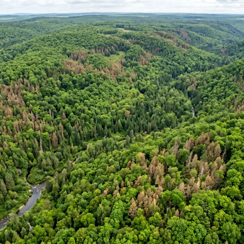
- Spot Tree Mortality: Brown or grey patches often mean trees are dying or already dead. Satellite imagery can pick up these shifts quickly, giving land managers a heads up before things get out of hand.
- Detect Deforestation: Clearcutting and illegal logging stand out like a sore thumb. Satellite views instantly reveal new gaps or roads in forested areas.
- Monitor Fire Damage: Burn scars from wildfires are easy to track, and multidate imagery lets you measure forest recovery or further losses over months or years.
- Assess Pest and Disease Outbreaks: Sudden color changes over a broad area may signal a bug infestation or pathogen sweeping through.
- Evaluate Reforestation Efforts: Newly planted trees and regrowing patches can be tracked to see if restoration projects are working.
Most of these insights come from special combinations of “bands” (portions of the electromagnetic spectrum) detected by satellites. For example, the Normalized Difference Vegetation Index (NDVI) helps measure plant health by comparing light reflected in the red and near infrared bands. A low NDVI means stressed or sparse vegetation, while a high NDVI points to a lush, healthy forest. These band combinations also let us track seasonal changes and subtle shifts year over year, providing evidence for long term trends.
How to Get Started With Satellite Imagery for Forest Monitoring
Jumping into satellite imagery can feel intimidating at first, but there are step by step ways to get the hang of it:
- Pick Your Region of Interest: Decide what forest you want to follow. It could be a local park, a national forest, or even a rainforest on another continent.
- Find Open Access Satellite Data: Platforms like USGS Earth Explorer and Copernicus SciHub offer free access to tons of helpful satellite imagery.
- Jump Into Online Visualization Tools: Instead of downloading and processing raw satellite data (which can be a hassle if you don’t have powerful computers), try online tools like Google Earth Engine or EMAPR. These platforms let you explore satellite images, calculate indices like NDVI, and see changes over time without technical headaches.
- Look For Changes Over Time: Pull up images from different years or seasons and compare them side by side. You’ll be amazed how quickly you can spot trends, such as growing gaps in forest cover or steady greening after restoration work.
- Get Involved With Citizen Science: Projects like Global Forest Watch let anyone help flag changes, report forest loss, and track alerts on illegal activities or natural events.
Getting comfortable with these basics can really give a boost to your ability to understand and communicate about the health of forests in your area or anywhere in the world. You can also join online communities, read case studies, or take free courses to broaden your skills.
Things to Keep in Mind When Using Satellite Imagery
While satellite imagery is super useful, there are a few things I always remind myself before making big conclusions or sharing data with others:
- Image Resolution: Not all satellites can capture fine details. Some images might let you see individual tree crowns, while others only show broad patches of color. Check the resolution and pick the right tool for your needs.
- Cloud Cover: Clouds can block the view, especially in tropical or rainy areas. Look for cloud free images or use satellites that capture data in different wavelengths or at more frequent intervals.
- Seasonal Variation: Trees change with the seasons, especially in temperate regions. Comparing summer to winter images might make a healthy forest look “dead” if you’re not careful. Always compare apples to apples; use similar times of year, whenever possible.
- Calibration and Corrections: Satellite sensors may change over time. Processed images with proper corrections give more accurate info, so double check data quality or use reliable sources.
- Local Knowledge: Even high tech tools benefit from on the ground knowledge. Satellite images can hint at a problem, but field checks confirm what’s really happening.
Cloud Cover and Shadow
One thing that trips up a lot of folks (myself included, early on!) is the effect of clouds and shadows in the images. Satellite data from optical sensors can be blocked by clouds, and even thin clouds may dim the picture. Shadows from hills or mountains may also hide some parts of the forest. If you’re really checking out data, look for imagery marked as cloud free or use radarbased satellites, which “see through” clouds and work day or night.
Understand Different Satellite Types
There are several satellite systems that are pretty handy for forest monitoring. Landsat has been rolling since the 1970s and offers long term records, while Sentinel2 gets updated every few days with sharp, multiband images. Some commercial satellites offer even higher detail, but they can get pricey. Open data sources are usually enough for most conservation or hobby projects.
Smart Ways to Use Satellite Data for Forest Conservation
Researchers and NGOs use satellite imagery for all sorts of smart conservation actions, including:
- Spotting illegal deforestation so local authorities can step in quickly
- Tracking how protected areas perform over time to see which strategies work best
- Analyzing forest recovery after wildfires or hurricanes
- Building models to predict future risks, like drought related dieback
- Helping governments plan sustainable logging and conservation zoning
When forest monitoring uses both satellite data and boots on the ground research, the results are more reliable. Local forest workers, researchers, and even drone pilots often use these views from space to know exactly where to check next or focus resources where they matter most. These collaborations between satellites and field experts help make sure data truly benefits the forests and communities that depend on them.
Frequently Asked Questions About Satellite Imagery and Forest Health
Lots of people have questions about how this all works, so here are a few I hear most often:
Question: How often do satellites capture new images of forests?
Answer: Public satellites like Landsat revisit every 16 days, while Sentinel2 can provide updates every 5 days. Commercial satellites may have even more frequent passes, depending on their orbit.
Question: Can satellite images show the types of trees or just general forest cover?
Answer: Most satellites focus on broad color/tone, so they’re best for tracking overall cover and health. Sometimes you can spot broad types (deciduous vs. evergreen), but identifying species requires higher resolution tools or fieldwork.
Question: Is special software required to view or analyze satellite imagery?
Answer: Some basic online tools, like Google Earth Engine, make it easy to explore and analyze satellite data right in your browser. For checking out details, software like QGIS or ArcGIS is pretty handy, but not always essential for simple projects.
Question: Is satellite imagery free to access?
Answer: A lot of high quality satellite data is openly available, such as from the Landsat and Sentinel programs. Commercial satellites usually charge fees for higher resolution images, but you’ll find enough free data for most forest monitoring tasks.
Why Satellite Forest Health Monitoring Matters
Forests do a lot for us: storing carbon, cleaning the air, supporting wildlife, and providing resources for people. Quick, accurate monitoring helps protect these ecosystems far better than old school methods ever could. Satellite imagery isn’t just about pretty pictures; it’s a real game changer for forest conservation, making it possible to protect what matters before issues spin out of control.
Getting started is easier than ever, thanks to open data and easy to use platforms. Even if you’re just curious or want to help out a local project, satellites offer a window into the “lungs of the planet,” and that’s something worth checking out, no matter your background or technical skills.
Tools for reading a tree’s health on Amazon
Botanicus Plus an AI PLUGIN for starters and experts
Botnicus Plus boasts an array of new features, enhancing its global appeal and user interaction. These include: 1) Multilingual Support for accessibility in various languages. 2) Virtual Tours of famous botanical gardens and historical plant sites. 3) A Botanical Identification Tool for users to upload and identify plants. 4) Seasonal Guides and Tips tailored to local climates and regions. 5) Opportunities for users to engage in Collaborative Projects and Citizen Science Initiatives. 6) Advice on Sustainable Gardening Practices. 7) Interactive Q&A Sessions with botany experts. 8) Personalized Plant Care Reminders for gardeners. These features enrich Botnicus Plus’s mission to provide comprehensive, interactive, and culturally rich botanical education, fostering a deeper connection with the natural world.
Botanicus-plus Plugin